Ride 2022 - Back to the Sea Leg
- Back to the Sea Leg: Bourke to Brewarrina to Narrabri to Bingara to Uralla to Walcha to Port Macquarie: May 26, 2022 to June 6, 2022. 900 kms, 7,939 m climbing and 2 exploring/rest days. $1,675
- Download itinerary covers both outward and inward legs
- Download registration and medical forms here
The Back to the Sea leg starts in Bourke and heads due east to start the climbing to reach the top of the Great Divide between Uralla and Walcha and dropping down to end in Port Macquarie on the banks of the Hastings River
Download Forms: Please complete a registration form. You will also need to complete and sign the medical information form, which includes a disclaimer form. Cycle Across Oz also operate a code of conduct and a Covid-19 policy which you will need to read and sign.
Download and print registration and medical information forms and mail to us with your deposit of AUD300 as soon as possible to secure your place. Places are filling fast.
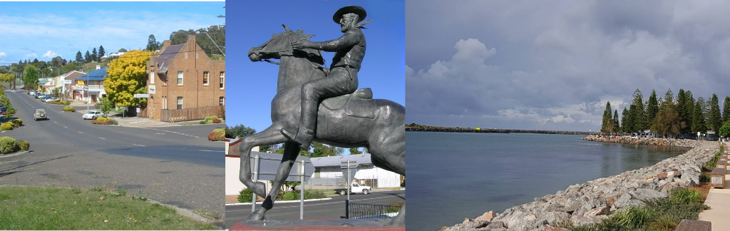
The ride starts in Bourke on the banks of the Darling River. There is plenty to see and do here on the rest day between legs or if you are joining the tour here. Hark back to the grand old days when Bourke was the transportation centre for the central west of New South Wales.
The ride is characterised by some long days. Starting in Bourke on the Darling River we start off with 3 days of 100 kms or more with stops in Brewarrina, Barwon Inn and Narrabri which is the first rest day. Roads are flat and all we can hope for is "no headwinds".
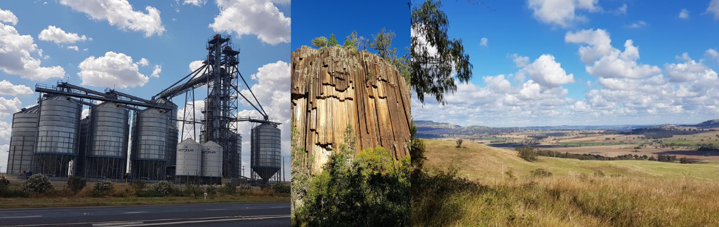
From Narrabri, the route begins working its way into the foothills of the Great Divide - be sure to take the walk to the Sawn Rocks, Australia's best example of organ-piping rock. From first stop at Bingara, the route follows the tumbling Gwydir River into New England High Country (yup Australia has one too). This is a country of rolling hills and expansive forests. We take a rest day in Uralla, which is on the highest tableland on the Great Dividing Range.
From Uralla, we cross the Thuderbolts Way (this is ranger country) and climb up to Walcha passing the highest point of the trip at 1,172 metres. From there we drop down to Long Flat before reaching Port Macquarie on the banks of the Hastings River.
The ride is characterised by some long days. Starting in Bourke on the Darling River we start off with 3 days of 100 kms or more with stops in Brewarrina, Barwon Inn and Narrabri which is the first rest day. Roads are flat and all we can hope for is "no headwinds".
From Narrabri, the route begins working its way into the foothills of the Great Divide - be sure to take the walk to the Sawn Rocks, Australia's best example of organ-piping rock. From first stop at Bingara, the route follows the tumbling Gwydir River into New England High Country (yup Australia has one too). This is a country of rolling hills and expansive forests. We take a rest day in Uralla, which is on the highest tableland on the Great Dividing Range.
From Uralla, we cross the Thuderbolts Way (this is ranger country) and climb up to Walcha passing the highest point of the trip at 1,172 metres. From there we drop down to Long Flat before reaching Port Macquarie on the banks of the Hastings River.
Weather - Back to the Sea Leg
The pictures below cover wind (the most important one on top), temperature and rain. The Bureau of Meteorology has stopped publishing free wind maps. This chart shows the percentage of time wind blows a particular direction by month. The first chart is for Narrabri. The second chart is for Port Macquarie. For May, the probability of a south or westerly flow (i.e., friendly) is between 30 and 40%. Closer to the coast, the chances of north or east flows is higher - that is fine as we are travelling South East at that stage. If we get a late season like 2019, the northerly and easterly percentage could be higher. Be prepared to ride some long hours in the wind.
Type in your location in the search box on this WeatherSpark site and find the charts needed along the way
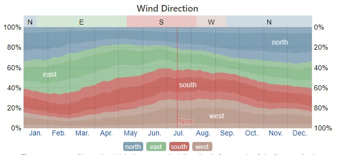
Wind Narrabri
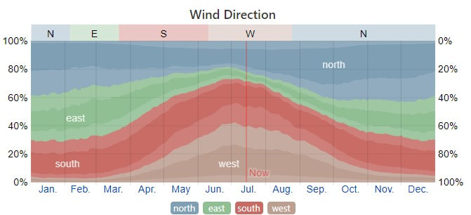
Wind Port Macquarie
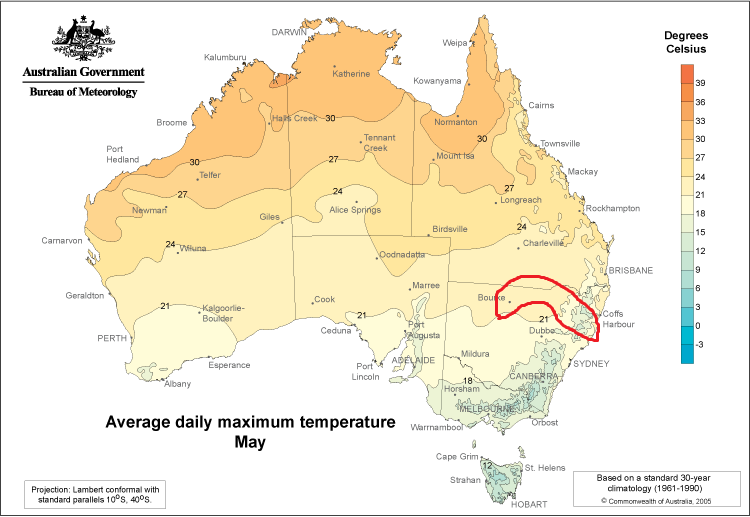
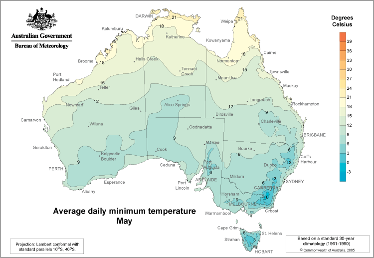
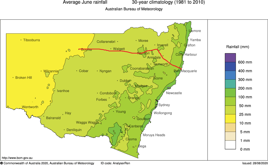
The broad tour area is highlighted on the maximum temperature map. The general route is on the rainfall map
For temperatures we will expect maximum temperatures to be in the 18 to 21 C band (60 to 70F). Minimums will be between 3 and 9C (45 to 50F) - colder in the mountains. Monthly rainfall is between 25 and 100 mm (1 to 4 inches) in June - riders could get a little wet.
For temperatures we will expect maximum temperatures to be in the 18 to 21 C band (60 to 70F). Minimums will be between 3 and 9C (45 to 50F) - colder in the mountains. Monthly rainfall is between 25 and 100 mm (1 to 4 inches) in June - riders could get a little wet.