Ride 2022 - Murray River Leg
- Murray River Leg: Adelaide to Milang to Mannum to Renmark to Waikerie to Werrimull to Wentworth (NSW): May 3, 2022 to May 12, 2022. 665 kms, 3,414 m climbing and 3 exploring/rest days. $1,250
- Download itinerary covers all three legs
- Download registration and medical forms here
The full tour begins in Adelaide and heads south to the mouth of the Murray River and then follows the Murray River until it crosses into Victoria past Renmark and onto Mildura and into New South Wales to end in Wentworth.
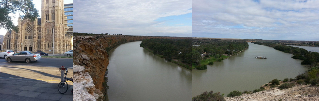
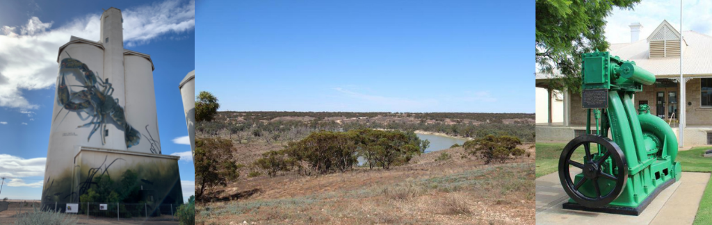
This trip brings together a huge slice of what downstream Murray River offers - pastoral lands, towering cliffs, wide riverscapes and paddle steamers.
The tour follows minor roads wherever possible - better scenery, quieter and safer. Sections of the Sturt Highway (A20) in South Australia cannot be avoided but it does have a shoulder for a lot of it. Traffic is mostly quiet other than close to towns.
Download Forms: Please complete a registration form. You will also need to complete and sign the medical information form, which includes a disclaimer form. Cycle Across Oz also operate a code of conduct and a Covid-19 policy which you will need to read and sign.
Download and print registration and medical information forms and mail to us with your deposit of AUD300 as soon as possible to secure your place. Places are filling fast.
The 2022 tour starts in the city of Adelaide, South Australia's capital. Take your time to enjoy the city before the tour begins, especially its shopping and its restaurants and its bicycle paths and its wineries.
The Murray River leg starts in West Beach in Adelaide. We follow bike paths and keep St Vincent Gulf close to our right as we work our way through Glenelg and Noarlunga before crossing into wine country and down to Port Elliot. Next day is the time we see the Murray River mouth lookout in Goolwa before heading to Milang, on the banks of Lake Alexandrina. Then it is a bit of a cross country leg to Mannum, an important historical Murray River port.
The next leg takes us along the Murray River past Walker Flat and Nidottie with towering cliffs over the river and up to Blanchetown. We keep following the river as it loops past the historic port town of Morgan on the route to Waikerie and a rest day. We cross to the north side of the river here to avoid the Sturt Highway and pass Overland Corner for the run to Renmark.
From Renmark, there is a spell on the Sturt Highway as we cross into Victoria to find a quiet back road for the run to Werrimull Outback pub. Last day of the ride skirts Mildura on the way to the first end point in New South Wales, Wentworth.
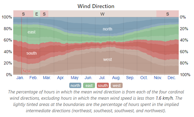
Weather - South Australia - Murray Leg
The pictures below cover wind (the most important one on top), temperature and rain. The Bureau of Meteorology has stopped publishing free wind maps. This chart shows the percentage of time wind blows from each of the 4 cardinal directions by month. It is for the town of Renmark which is close to the middle of this leg. This suggests that the dominant wind direction is West and South West up to 60% of the time. That leaves a 40% chance of north easterly flows especially further east.
Type in your location in the search box on this WeatherSpark site and find the charts needed along the way
Wind Lakes Entrance
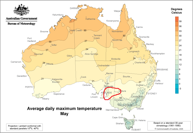
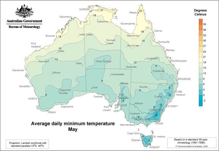
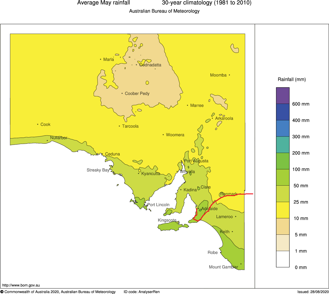
The broad tour area is highlighted on the maximum temperature map. The general route is on the rainfall map - it does go off the map as the tour goes into Victoria and NSW.
For temperatures we will expect maximum temperatures to be in the 18 to 21 C band (60 to 70F). Minimums will be between 6 and 9C (45 to 50F). Monthly rainfall is between 10 and 50 mm (1/2 to 2 inches) in May. Closer to the coast on those first few days, this could stretch out over a spell of a day or two.
For temperatures we will expect maximum temperatures to be in the 18 to 21 C band (60 to 70F). Minimums will be between 6 and 9C (45 to 50F). Monthly rainfall is between 10 and 50 mm (1/2 to 2 inches) in May. Closer to the coast on those first few days, this could stretch out over a spell of a day or two.